Latest Radar GPS News & Updates
Welcome to the official Radar GPS News page from Lufop.net ️. Here you’ll find all the latest published articles: monthly radar updates, personalized alerts, mobile applications, POI tutorials, legal updates, and more. This page is regularly updated to provide you with reliable, useful, and up-to-date information for safer driving.
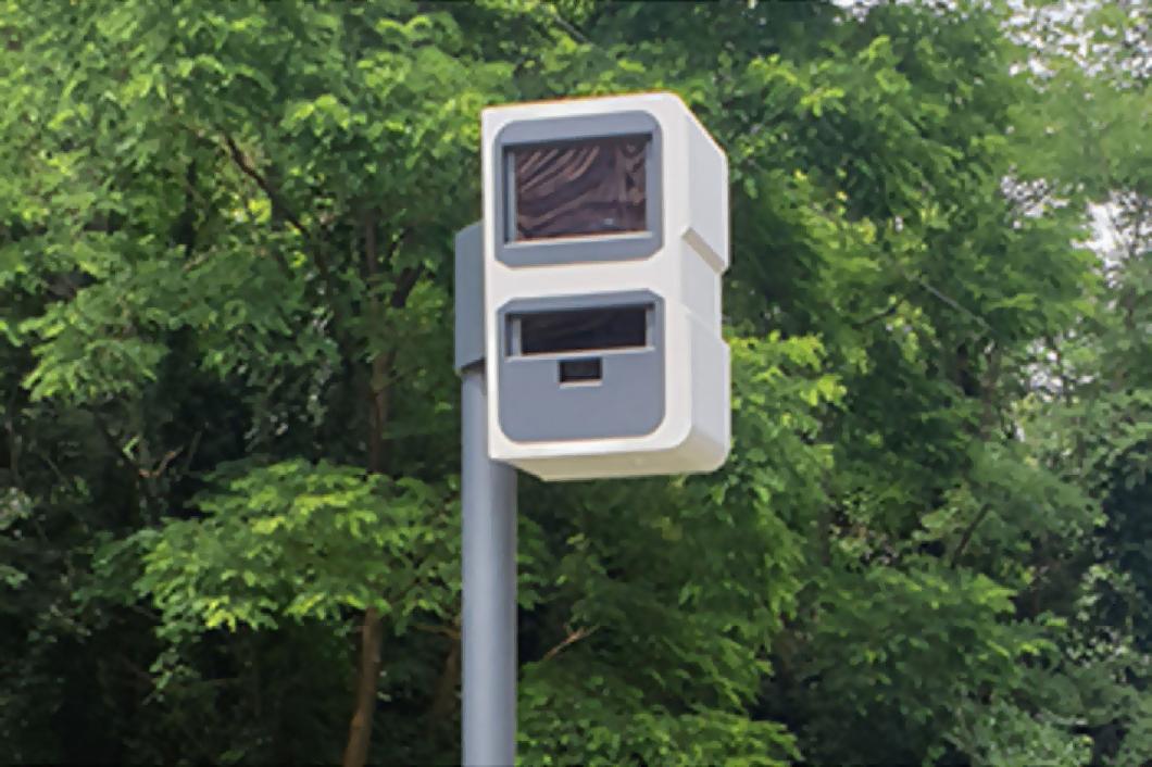
Morocco Introduces Next-Generation Bidirectional Speed Cameras in 2025

In 2025, Morocco is taking a decisive step forward with the introduction of next-generation bidirectional speed cameras across its entire road network.
In a country still marked by tragic accident figures, this innovative system aims to improve driver and pedestrian safety while ensuring fairer and more effective enforcement. What benefits can be expected from this technological revolution?
1. The current state of road safety in Morocco
With over 4,000 road deaths in 2024 and a worrying increase in accidents, the situation remains alarming (road safety key figures Morocco 2024).
Pedestrians and two-wheeler drivers are the most affected, accounting for nearly 60% of victims.
To reverse this trend, NARSA relies on modernizing equipment, educating users, and enforcing stricter legislation (national road safety strategy 2017–2026).
2. Why bidirectional speed cameras?
Fairer and more effective control
Until 2025, fixed speed cameras in Morocco monitored only one direction of traffic, leaving blind spots exploited by reckless drivers.
Since June 2025, the bidirectional system ensures symmetrical coverage, reinforcing deterrence (bidirectional radars Morocco).
- Elimination of monitoring blind spots
- Simultaneous surveillance in both directions
- Reduced risky behavior on major roads (new radar rules Morocco 2025)
Targeting dangerous areas
The first devices were installed on the most accident-prone sections to maximize impact (black spots accidents Morocco).
3. How do these radars work?
Deployment and coverage
The network now includes:
- 670 modern fixed speed cameras
- 780 mobile radars deployed by the gendarmerie and police (number of radars in Morocco)
A fully digital system
The radars capture offenses in real time, in both directions, and send the data to an automated control center (smart radars Morocco).
The fully digital chain — from capture to payment — guarantees efficiency and traceability.
4. A comprehensive and sustainable strategy
Objectives of the national strategy
Integrated into the National Road Safety Strategy 2026, these devices aim to:
- Halve the number of road deaths by 2026
- Modernize infrastructure
- Raise awareness among the most vulnerable groups (road safety prevention actions Morocco)
Education and sanctions
Summer 2025 also saw the creation of road safety villages and tougher penalties for unpaid offenses (road safety campaigns Morocco 2025).
5. Early results and remaining challenges
Despite an initial increase in accidents during the first five months — highlighting the urgency of action — bidirectional speed cameras are expected to gradually reduce road mortality through their deterrent effect and consistent coverage (impact of bidirectional radars).
The main challenges:
- Social acceptance of increased surveillance
- Risky behavior on roads not yet equipped
- Adapting awareness campaigns to local realities (road safety challenges Morocco)
Conclusion
The arrival of bidirectional radars marks a technological revolution for Moroccan road safety.
Fairer, smarter, and more deterrent, they represent a decisive step toward safer roads.
But technology cannot replace individual responsibility: every driver holds the key to safer roads.
“Vigilance is the driver’s best life insurance.” 🚦
Free Speed Camera Update for Mercedes-Benz MBUX GPS Navigation
A fantastic step-by-step tutorial generously shared by ravax, a member of the Lufop community. A big thank you to him for this great contribution!
This complete guide will walk you through the process of updating your Mercedes GPS navigation system with the latest Speed Camera POI files from Lufop.net. Follow the instructions and enjoy a free speed camera update including fixed and mobile radars for several countries: France, Spain, UK, Belgium (Wallonia), Switzerland, Poland, Sweden, and more across Europe.
📥 Download the Speed Camera Files for MBUX
|
|
Téléchargement : Zones de danger Mercedes Comand/MBUX (EU) 442.05KB Nombre de téléchargements : 17302 Date de mise à jour : 10/09/2025 à 07:06:06. Description : Les zones de danger Europe pour les GPS Comand qui équipent les véhicules de marque Mercedes. |
🔧 Installation Instructions for Mercedes MBUX GPS (Speed Camera POI)
1 – Prepare your USB stick
Format a USB key in FAT32.
Copy the downloaded folder to the root directory.
Alternatively, create a new folder and only include the countries you’re interested in.
The essential requirement: a folder named “PersonalPOI” must be at the root of the USB stick.
2 – Plug into your Mercedes
Insert the USB stick into the armrest port, especially if the main USB port is used for Apple CarPlay or Android Auto.
You can keep your music and video files on the same USB – it won’t interfere.
3 – Go to your navigation settings
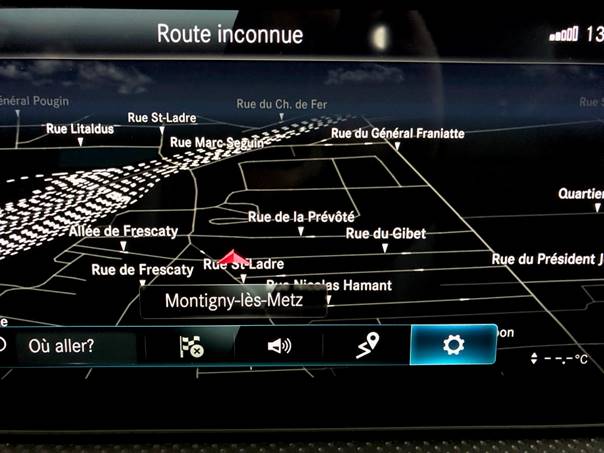
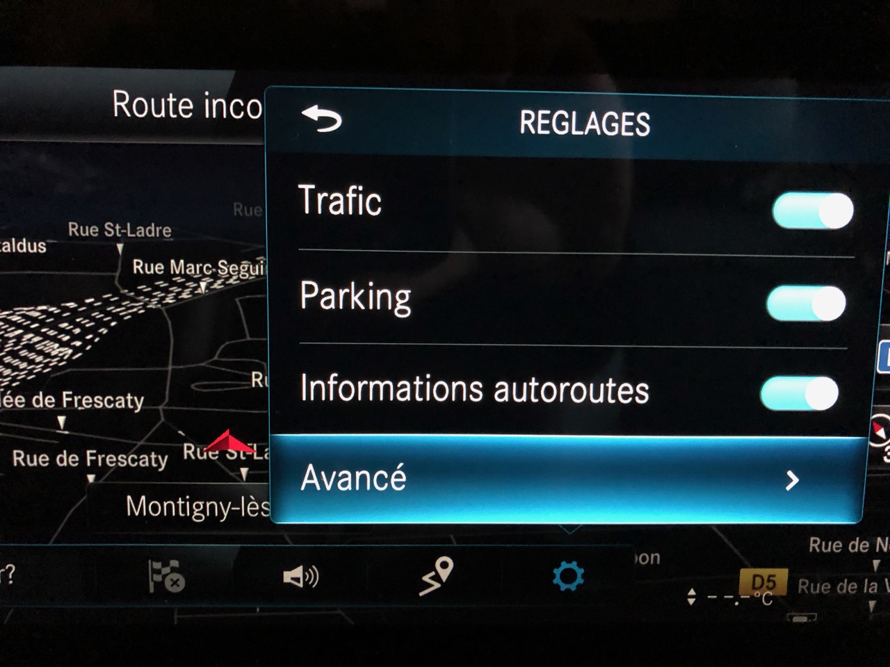
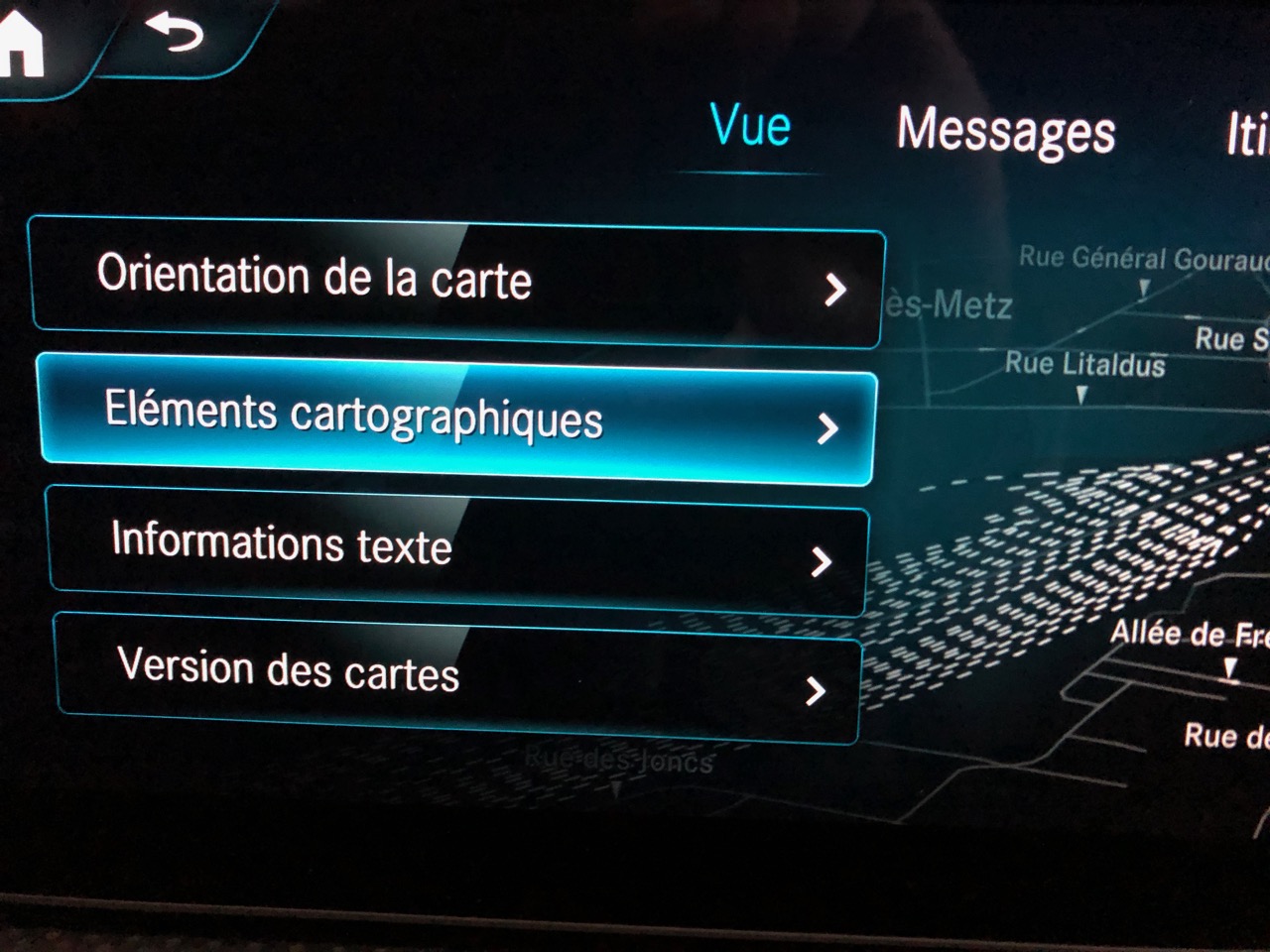
Open the map view and select the gear icon (⚙️) to access settings.
4 – Activate Personal POIs
Go to:
Settings > Advanced > Map Content > Special Destination Symbols > Personal POIs
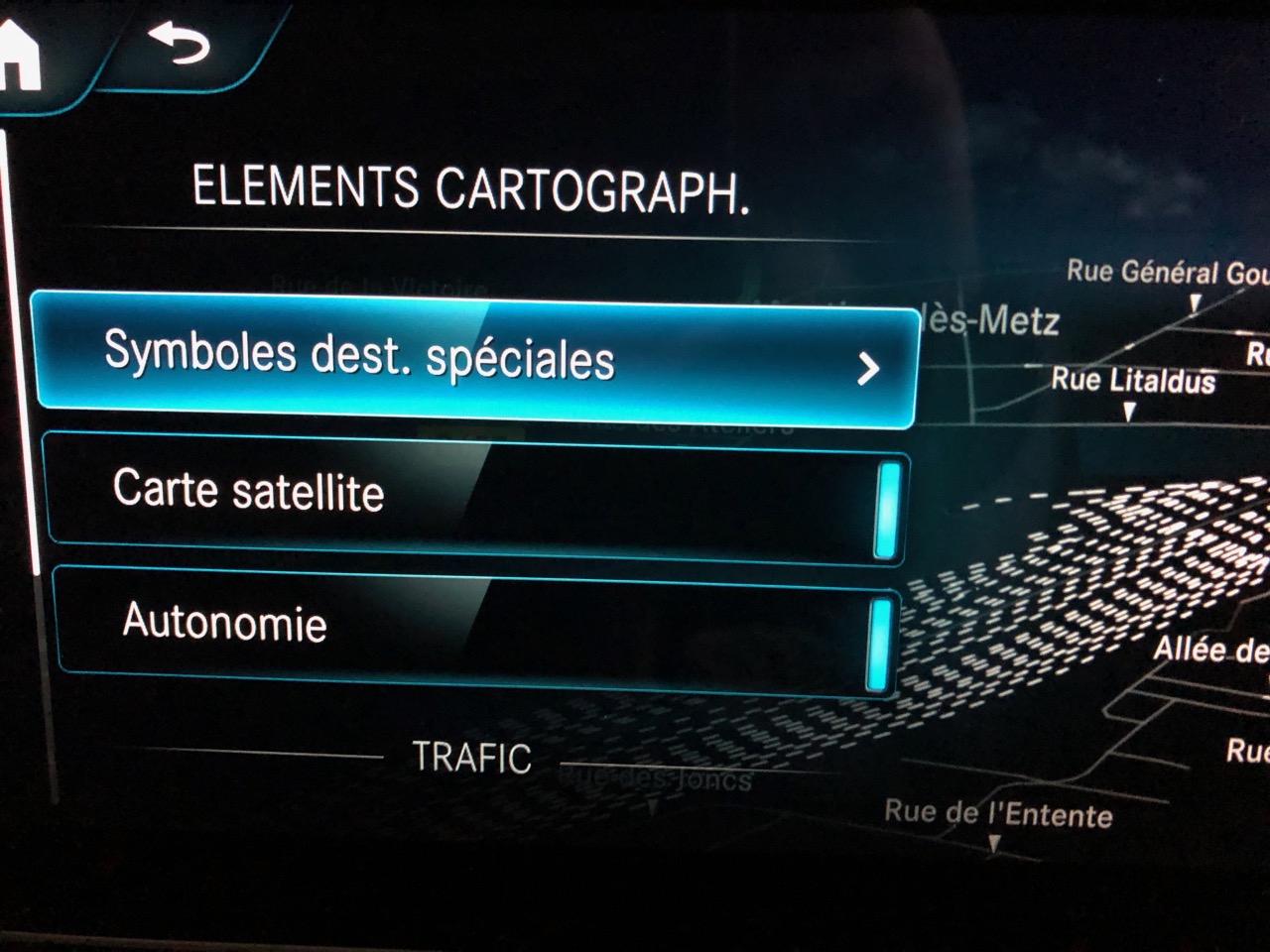
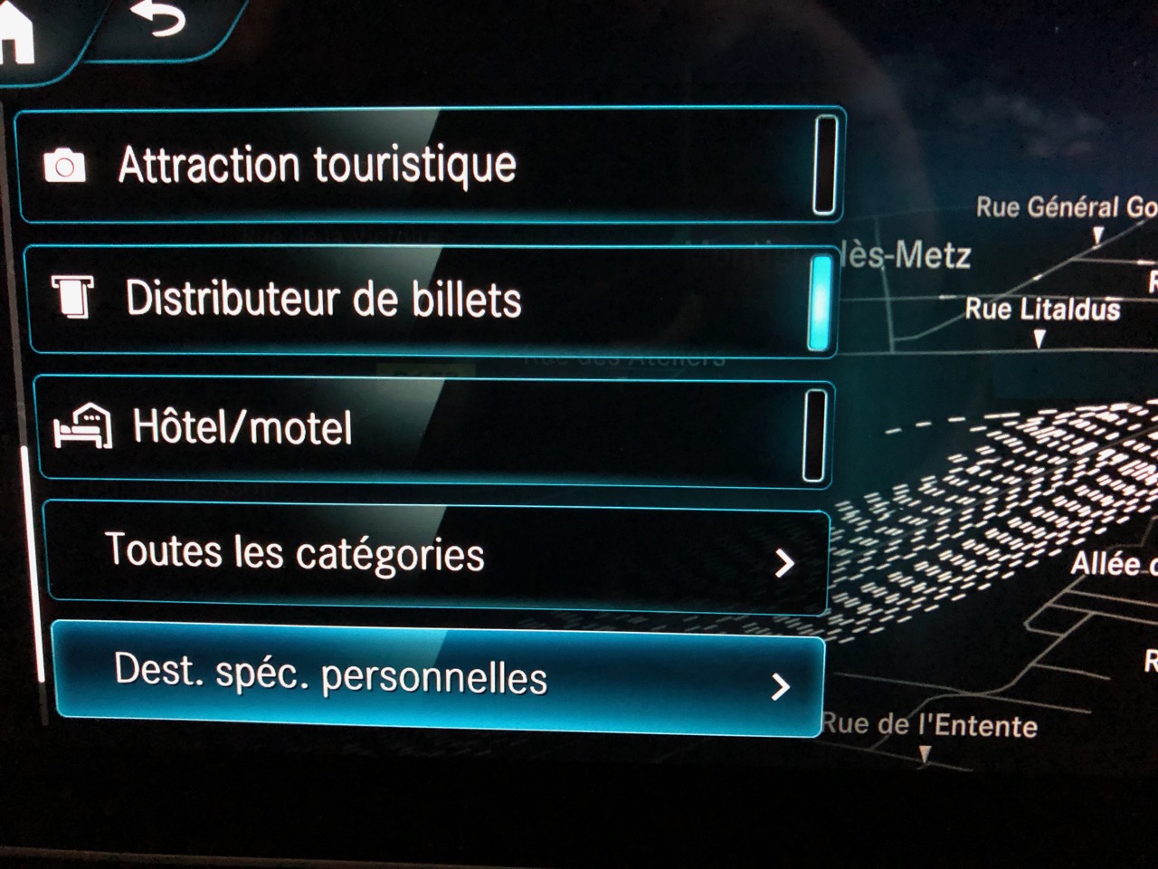
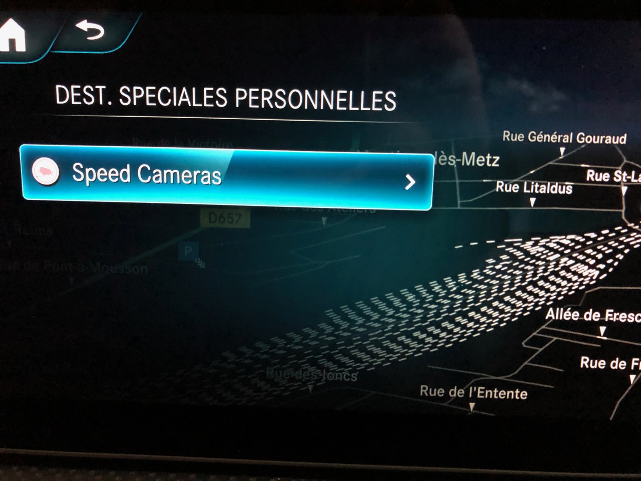
If everything is done correctly, you should see the POI category displayed — in this case, “Speed Cameras”.
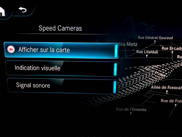
5 – Configure your alerts
Click on Speed Cameras and choose your preferences:
Display on map
Visual warning
Sound alert
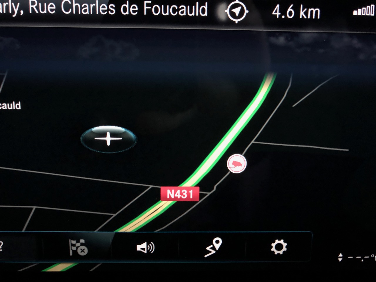
✅ Final Result
⚠️ Important Note
Your USB stick must remain plugged into the car — it’s not possible to copy the POI files into the internal memory of the Mercedes MBUX system.
Urban Speed Cameras in France: How They Work and What to Expect in next year ?
A new face for urban traffic enforcement
Over the past few years, France has been modernizing its urban traffic enforcement tools. The main goal: to better protect vulnerable road users (pedestrians, cyclists, children) and improve safety at hazardous intersections. It is within this context that urban speed cameras have been introduced — a new generation of devices that are more discreet, more mobile, and more intelligent.
What is an urban speed camera?
Unlike traditional fixed speed cameras, urban radars are designed to blend into the urban landscape without being easily noticeable. Installed on lamp posts, traffic lights, or other street furniture, they are typically signaled by a small discreet sign placed only 20 to 30 meters ahead. Their goal isn’t to trap drivers, but rather to deter dangerous behavior in urban areas.
These devices can currently detect several violations: speeding, running red lights, and soon other risky behaviors such as mobile phone use while driving or encroaching on bicycle lanes.
Deployment of urban radars in France
The rollout began in 2021 with a pilot phase in several test cities. By January 2024, the system became fully operational. The first cities to be equipped included Marseille, Montbéliard, Sochaux, Toulouse, and the Territoire de Belfort.
Since then, many urban areas have followed. Urban radars can now be found in:
- Montpellier
- Marseille
- Montbéliard
- Belfort
- Toulouse
Other cities like Metz, Lille, Bordeaux, and Dijon are on the list for 2025. In total, more than 500 additional urban radars are expected to be installed over the next two years.
A national system with high potential
In 2023, there were around 3,500 automatic traffic cameras installed in urban areas in France. Thanks to new legislation — especially the 3DS law — local authorities can now request and install their own radars under State supervision. This significantly accelerates nationwide coverage.
These devices are strategically positioned: accident-prone intersections, areas near schools, high-traffic roads, or zones with frequent citizen complaints.
Two main models
Two primary urban radar models are currently in use:
- The Nomad by Parifex – mostly deployed in northern France
- The Mesta Compact by Idemia – more common in the south
Both models share several features: compact size, advanced embedded technology, and the ability to operate as decoys (some units are inactive and rotate locations to confuse drivers).
Technology and how it works
These radars are equipped with Doppler sensors, infrared cameras, and sometimes intelligent image recognition systems. Unlike older models, they do not use a visible flash, making them much harder to spot.
They can monitor traffic in both directions. Each unit is currently programmed to detect only one type of violation at a time — either speeding or red-light running.
However, starting in 2025, some next-generation urban radars will be able to detect multiple infractions simultaneously:
- Speeding
- Running red lights
- Phone use while driving
- Seatbelt not fastened
- Driving in bike lanes
- Tailgating (unsafe following distance)
- Failure to stop at stop signs
Violation processing
Once a violation is recorded, a timestamped image is automatically sent to the National Processing Center based in Rennes. The fine is then generated and mailed directly to the registered vehicle owner.
The entire process is automated, requiring no human intervention. This allows for faster processing and a scalable enforcement model.
A tool for safer cities
Urban radars are not just about punishment — they are part of a broader policy aimed at reducing road fatalities. In 2023, urban areas accounted for 68% of pedestrian deaths in France, according to the French Road Safety Authority (source).
By identifying hazardous areas, limiting speeding, and collecting traffic data, these radars also help local governments make better infrastructure and mobility decisions.
What about the fines?
The expansion of urban radars inevitably leads to an increase in fines. However, part of the revenue is reinvested in sustainable mobility initiatives:
- Development of secure bike lanes
- Expansion of pedestrian zones
- Improved road signage and markings
These reinvestments are state-regulated and aim to make cities more accessible, greener, and safer for everyone.
FAQ – Frequently Asked Questions
- Can an urban radar detect multiple violations at once?
- Not yet. Currently, each radar is limited to a single type of infraction, but this is expected to change in 2025.
- Are these devices really invisible?
- They’re extremely discreet — often integrated into street fixtures and using infrared instead of a visible flash.
- How can I know where they’re installed?
- You can check the national radar map or use updated GPS apps like Waze or Coyote.
- Can local mayors install them?
- Yes, under the 3DS law, municipalities can request radars to be installed in their jurisdiction with State coordination.
Conclusion: building calmer cities
Urban speed cameras are set to become a key part of road safety strategy in French cities. Thanks to their advanced technology, adaptability, and discreet design, they are helping transform urban spaces into safer, more fluid environments for everyone.
They’re not meant to trap — they’re here to protect. So drive mindfully, ease off the gas, and keep your eyes open. 😉
Vacation in Spain: Why You Must Update Your GPS Speed Cameras Before Hitting the Road
 Driving through Spain on vacation promises stunning coastlines, sunny skies, and unforgettable landscapes… but it can also come with unexpected surprises if you’re not prepared: hefty fines for speeding or entering restricted zones, thanks to an extremely well-developed radar enforcement system.
Since May 2025, Spain has tightened its traffic laws to a zero-tolerance approach. Go just 6 km/h over the limit on the highway, and you could get flashed. That’s why it’s essential to update your GPS with the latest speed camera data before hitting the road.
🚦 A country covered with radars – and they work
Spain is among the most advanced countries in Europe when it comes to automated traffic enforcement:
- Highly accurate fixed speed cameras
- Mobile radars hidden in unmarked patrol cars
- Drones and helicopters monitoring major roads
- Multidirectional radars and double sensor setups
All violations are automatically recorded and tracked, including those committed by foreign drivers. Thanks to European cooperation, the fine will find its way to your mailbox back home.
💸 Speeding fines in Spain (2025)
| Speed Over Limit | Fine | License Points |
|---|---|---|
| Less than 20 km/h | €100 | 0 |
| 21–30 km/h | €300 | 2 points |
| 31–40 km/h | €400 | 4 points |
| 41–50 km/h | €500 | 4–6 points |
| Over 50 km/h | €600 | 6 points + possible criminal charge |
⚖️ Speeds over 70 km/h above the limit may lead to criminal proceedings and license suspension.
📏 The new “3 and 5” rule: razor-thin tolerance
Since May 2025, radar tolerances have been significantly reduced:
- +3 km/h for limits under 100 km/h
- +5% for limits over 100 km/h
For example, at 90 km/h, you can be fined starting at 93 km/h. On a 120 km/h highway, 126 km/h is enough to get flashed.
📱 Keeping your GPS updated = driving stress-free
Using outdated GPS maps or apps increases your risk of getting fined:
- You’ll miss newly installed fixed cameras
- You might not see recent changes in speed limits
- You risk losing license points without realizing it
🔍 And what about Waze?
- Yes, Waze is very helpful for mobile controls and traffic incidents.
- But it may not reliably display fixed speed cameras in Spain due to local regulations and limitations.
➡️ For best results, use a dedicated GPS device (TomTom, Garmin, Coyote) or apps that support official speed camera updates regularly.
📵 Other costly violations
- Phone use while driving: €300 to €600
- No seatbelt: automatic fine
- Driving under the influence: criminal penalties apply
🗺️ Interactive radar map for Spain
Before you drive, explore this updated map of fixed speed cameras and radar zones in Spain:
🧳 Before your road trip: checklist
- ✅ Update your GPS or app with the latest speed camera data
- ✅ Learn about local speed limits and traffic laws
- ✅ Activate real-time voice and visual alerts
- ✅ Check if your license plate is linked to rental contracts
- ✅ Don’t rely solely on Waze or intuition
🧠 Reminder: Foreign drivers are fully liable
Thanks to pan-European agreements, speeding tickets are enforceable even if you’ve returned home. Spanish radars read your plate and share the data with your home country’s authorities.
🌞 Conclusion: travel smart, not fast
Spain’s goal isn’t to punish tourists, but to reduce accidents and road fatalities. Speeding is still a leading cause of deadly crashes.
So before your next trip to Barcelona, Valencia, or the Costa del Sol, do yourself a big favor: update your GPS. It only takes a minute—and can save you hundreds of euros.
🧭 When was the last time you updated yours?
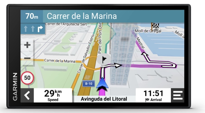
Install Speed Cameras and Alerts on Your Garmin DriveSmart
Have you just bought a Garmin DriveSmart GPS and want to add a speed camera or point of interest (POI) database? No worries! Even without technical skills, you can easily do it by following this step-by-step guide based on real feedback from the Lufop community.
Steps for a Successful Installation
- Prepare the Required Files
You will need three types of files for each POI:- A .CSV file (coordinates of the speed camera),
- A .BMP file (icon),
- A .WAV file (audio alert).
All files must have the exact same name (e.g., radar.csv, radar.bmp, radar.wav).
- Install POI Loader and Sox.exe correctly
– Download POI Loader (preferably version 2.7.3) from Garmin’s official website.
– Download the correct version of sox.exe: sox-14.4.zip
– Extract the sox.exe file (not the installer!) and place it in the same folder as POILoader.exe, for example: C:\Program Files (x86)\Garmin\POILoader. - Start Installation with POI Loader
– Connect your GPS to your PC.
– Launch POILoader.exe, choose the “Custom Installation” mode and select the folder containing your CSV/BMP/WAV files.
– Make sure the .GPI file is successfully created. - Check on Your GPS
– Go to “Categories” on your Garmin device.
– You should see your POI with the icon and hear the alert when approaching (in simulation or during navigation).
Extra Tips
- If the .wav file doesn’t affect the .gpi file size, it may not be processed correctly. Make sure it’s in PCM, 44.1 kHz, mono format.
- To create custom alerts, use a text-to-speech service and convert the MP3 to WAV with this online tool.
- Never place sox.exe inside the GPS device — only on your PC.
- Garmin GPS devices don’t read CSV files directly — only GPI files generated with POI Loader.
Need mode ?
With a bit of method and the right tools, installing a speed camera database on a Garmin DriveSmart is totally doable. And if you prefer not to customize, you can simply download ready-to-use GPI files from GPS-SNE.
Bonus resource: The website Lufop.net offers free, regularly updated Garmin speed camera files — definitely worth bookmarking!